
Exploring the Cultural Features of South Korean Cities: Discovering Various Tourist Attractions in Gunsan City, Jeollabuk-do – Including Mongdol Beach.
Daecheongbong : A Cultural Gem in South Korea
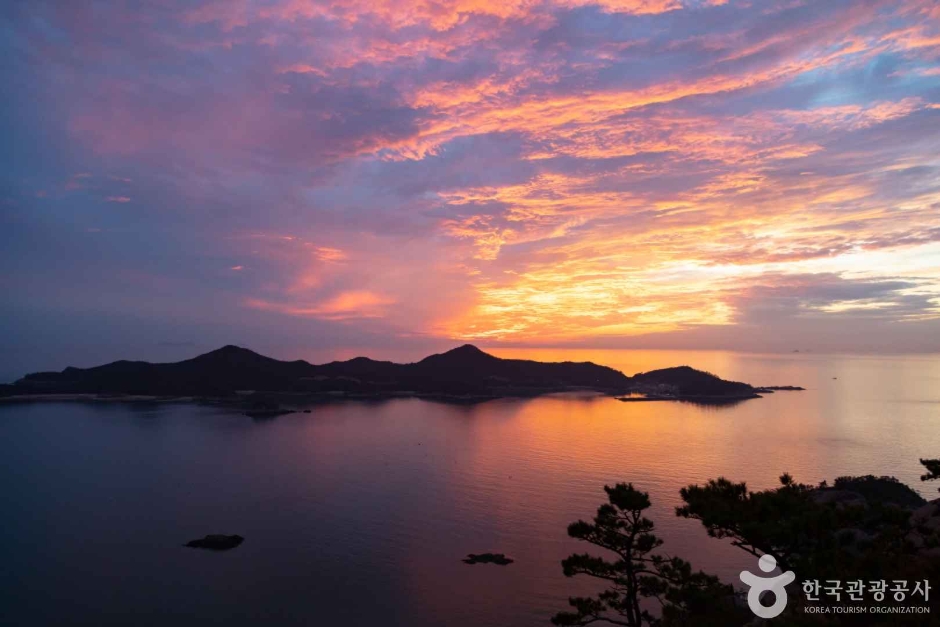
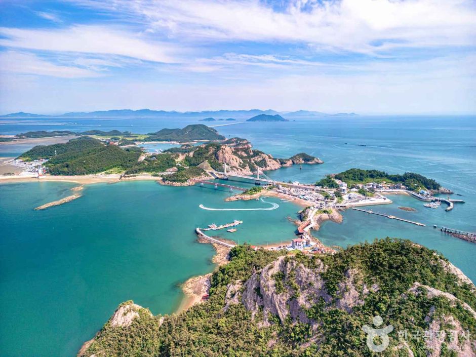
Daecheongbong is a peak located on Daejang Island in Gunsan, part of the beautiful Gogunsan Archipelago and overlooking the West Sea. It is a must-visit destination in Gunsan, offering stunning views of the Gogunsan Archipelago and the West Sea.
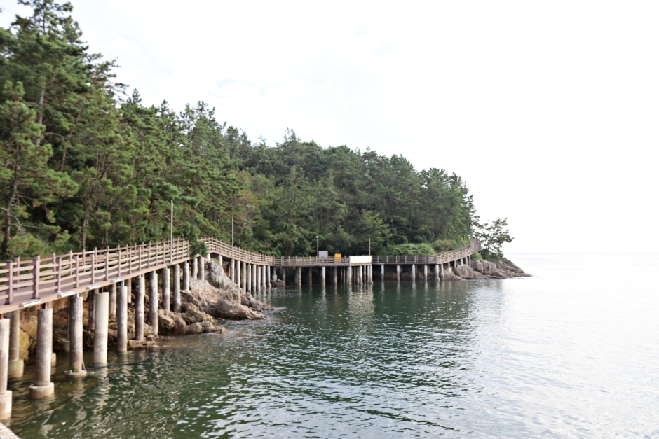
To reach the iconic Daecheongbong, visitors can take a winding path and climb wooden stairs for about 10-20 minutes, passing by Halmae Rock before reaching the observation deck. The panoramic view from Daecheongbong allows visitors to enjoy a 360-degree vista of the Gogunsan Archipelago, leaving them in awe of the breathtaking scenery.
To access Daejang Island, visitors must cross Jangja Bridge and walk onto Jangja Island. Due to vehicle restrictions on Daejang Island, visitors must park at the parking lot on Jangja Island. Nearby, there is the Jangja Bridge Skywalk that spans over the sea, offering another exciting attraction to explore in the area.
• Address (location): Dajangdori, Okdo-myeon, Gunsan-si, Jeollabuk-do
• Hours of use: Open all year round
Oseongsan : Discover the Charm of Gunsan
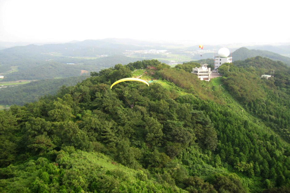
The name Oseongsan is believed to have originated from the presence of the graves of five generals who died defending Baekje from the invading forces of the Silla-Tang alliance during an attack in this area. On the summit of Oseongsan (227m), you can see the winding Geumgang River below and a row of five tombs, which are said to be the resting place of the five Baekje generals who sacrificed their lives to protect the country.
The view from Oseongsan’s summit offers a picturesque landscape. To the west, you can see the beautiful islands of the Gogunsan Archipelago. To the east are Mireuksan in Iksan and Moaksan in Jeonju. To the south, the Mangyeong River and Dongjin River flow like intertwined threads, and you can also see the majestic Ugeumbawi Rock of Buan Naebul.
Looking north, you can witness the impressive sight of the Geumgang River flowing under the mountain, with the energy of the dragons rising from Oseongsan, where the mountain ranges that originated from Baekdusan in the north dive into the Geumgang River and emerge with a vibrant spirit.
• Address (location): 38-12 San, Seongdeok-ri, Seongsan-myeon, Gunsan City, Jeollabuk-do, South Korea”
• Hours of use: “Open all year round
Geumgang Future Experience Center
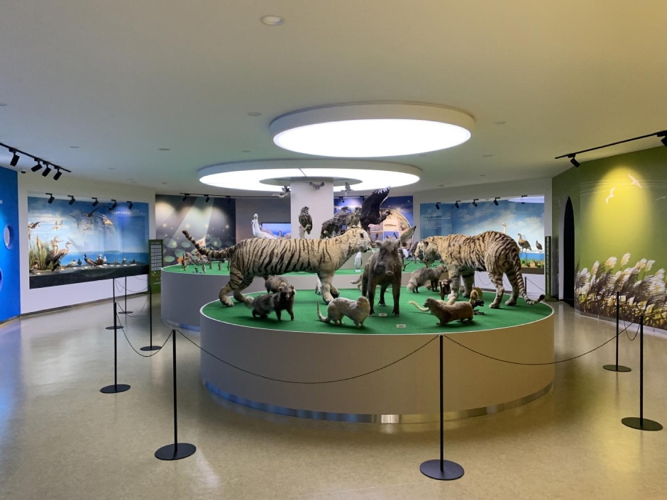
The Geumgang Future Experience Center, formerly known as the Geumgang Bird-Watching Tower, is located on the expansive mudflats and reed fields along the west coast of the Geum River in Gunsan, Jeollabuk-do. The center features exhibitions and experiential programs focused on the ecology of the Geum River and the climate crisis, as well as an outdoor eco-park.
Originally designed as a space for observing migratory birds in winter, the center has evolved in response to global warming and bird flu outbreaks. It now emphasizes education and hands-on experiences related to the Geum River’s ecosystem and climate change, reflecting a shift toward a more interactive and educational approach.
The first and second floors of the center showcase the culture and ecology of the Geum River. On the ninth floor, visitors can find exhibits of insect specimens and learn about the impact of climate change on insects. The tenth floor is dedicated to experiential activities related to climate change, water conservation, marine litter, resource circulation, and renewable energy. From the 11th-floor observation deck, visitors can enjoy panoramic views of the Geum River.
The outdoor eco-park includes the Maenggumsajang area, where visitors can observe eagles and Eurasian eagle owls, as well as a tropical plant garden, a meerkat exhibit, and a parrot area. There are also educational zones focused on climate change, resource circulation, solar and wind energy, water conservation, and marine litter. Visitors can take a leisurely stroll through the park while learning about ecology and the seriousness of the climate crisis.
Nearby attractions include the Geumgang Wetland Ecological Park and the Geumgang Cycling Path. The Geumgang Wetland Ecological Park, located across from the Geumgang Future Experience Center, offers a bamboo forest walking trail, ecological ponds, and a bird-watching path along the riverside, providing a tranquil setting for a leisurely walk and a picturesque spot to enjoy the sunset over the Geum River5. The Geumgang Cycling Path follows the riverbank and is popular among cycling enthusiasts, with a public bike rental station operated by Gunsan City at the entrance to the wetland park.
Through various Geumgang Future Experience Programs, visitors can learn about the importance of nature, ways to address the climate crisis, and the culture and ecology of the Geum River.
• Address (location): Geumgang Future Experience Center, 120 Cheolsae-ro, Gunsan-si, Jeollabuk-do
• Hours of use: – March to October: 09:00 AM to 06:00 PM
– November to February: 09:00 AM to 05:00 PM
* Closed on Mondays.
“Design your trip to Korea more intelligently with StepToKorea on your side.”
Geumgang Wetland Ecological Park
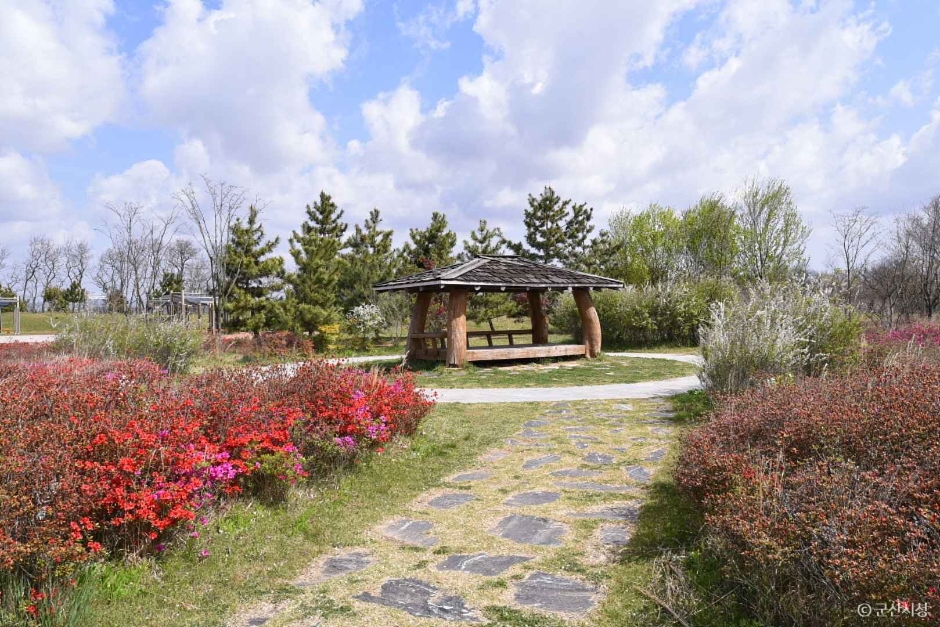
Geumgang Wetland Ecological Park is a spacious park created by Gunsan City along the Geum River as part of the Geumgang Riverside Tourism Development Plan. The park features a boardwalk through a reed forest and ecological ponds, a viewing deck where visitors can cross over, and a riverside bird-watching trail.
At the small hilltop within the park, a pavilion is built for visitors to enjoy a refreshing view of the Geum River. You can even rent bicycles for free at the park entrance, making it perfect for a hiking or cycling adventure.
The bird-watching tower located in the center is a symbol of the park and a renowned spot for birdwatching in Korea. In November, you can witness a breathtaking spectacle of millions of migratory ducks performing a mesmerizing dance against the backdrop of the crimson sunset painting the surface of the Geum River.
Apart from the unforgettable sight of various birds like mallards, Eurasian teals, shovelers, pintails, gadwalls, and more, accompanied by the grass and reeds, this park is popular among family travelers with children.
• Address (location): Seongdeok-ri, Seongsan-myeon, Gunsan-si, Jeollabuk-do
Napo Ecological Park and Bird Observatory
In Gunsan City, Nampo-myeon, the Nampo Crossroads Wild Bird Observatory is a stunning sight where every year around 100,000 migratory birds of over 40 species, including swans, mandarin ducks, cranes, and egrets, gather.
The observatory is designed to blend in with the natural surroundings, allowing birds to approach very closely without being disturbed by human presence. This thoughtful design makes it an exceptional spot for birdwatching and nature appreciation.
Additionally, near the village, you can explore the Chaeman Literary Museum, where you can experience the literary atmosphere of winter evenings.
• Address (location): 905-3 Okgon-ri, Napo-myeon, Gunsan-si, Jeollabuk-do
• Hours of use: Open all year round
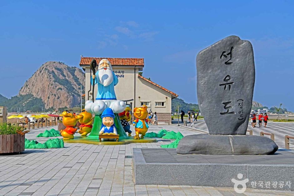
Sunyudo Walking Trail
The Sunyudo Coastal Trail, also known as the Curvy 8 Road or Gogunsan Road, can be divided into three main courses.
The first course takes you along the path from Sunyudo Myeongsasipri Beach, passing through Mangjubong and the Sunyu 3-gu Namaksan Ridge. Along this route, you can enjoy scenic views of Seonnyeobong, heart-shaped beaches, and the entire Gogunsan area.
The second course continues from the beach to Sunyu 1-gu, Seonyubong, Jangjado, and Daejangdo, offering another breathtaking view of the Gogunsan Archipelago. Bridges connect these islands, allowing visitors to easily walk or bike between them and enjoy the panoramic coastal scenery.
Lastly, the third course encircles Muneodo’s Muneobong and Muneo Yeomjeon, showcasing unique landscapes that cannot be found elsewhere.
Sunyudo and its surrounding islands are popular trekking destinations, boasting gentle slopes and coastal pathways that make them ideal for both hiking and biking adventures.
• Address (location): 37-1, Seonyu-nam-gil, Okdo-myeon, Gunsan-si, Jeollabuk-do
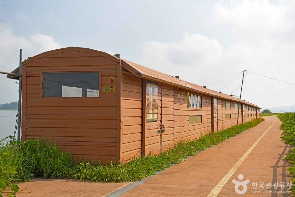
Discovering Mongdol Beach
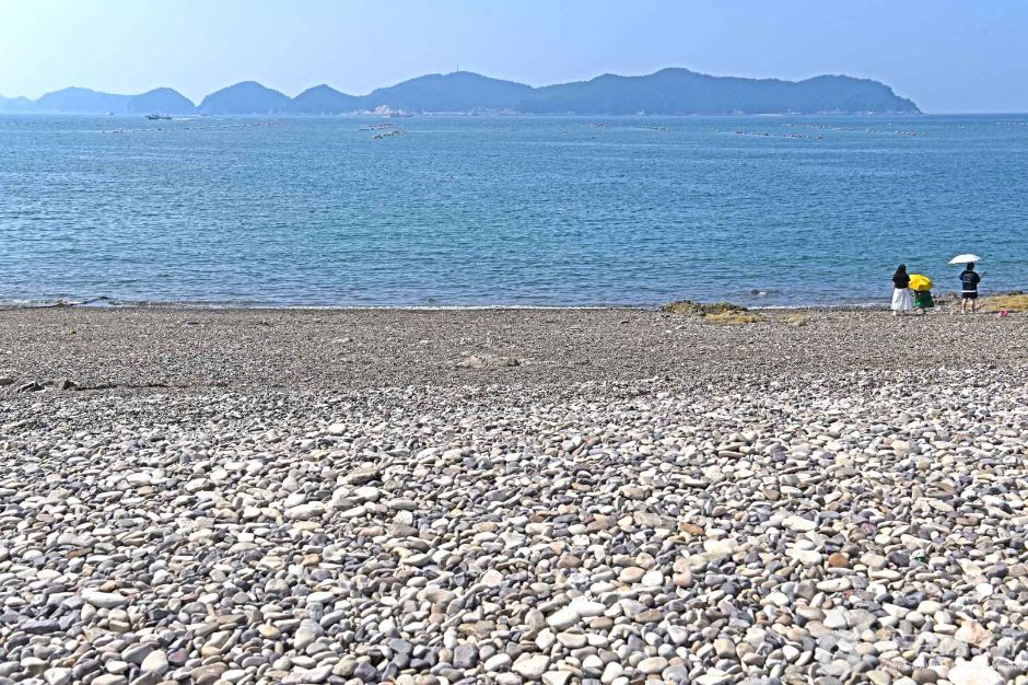
Gunsan’s Sinido Mongdol Beach is a beautiful natural landscape featuring charming round pebbles scattered along the shore. Stretching about 100 meters, the beach is not sandy but covered with smooth pebbles shaped by the waves, earning it the nickname ‘Mongdol Beach.’ The pebbles come in various sizes, all smooth and round, making it safe to walk barefoot without getting hurt. The sound of the pebbles clashing with the waves is both beautiful and impressive.
During the summer, visitors can enjoy the cool sea breeze and the panoramic view of the open beach. It is a perfect place for those looking to escape the city and relax while immersing themselves in nature. Surrounding the Mongdol Beach are facilities for various leisure activities, making it suitable for families as well.
Known as a picturesque spot for photography due to its stunning natural environment, it is also great for a leisurely stroll along the beach while gazing at Bangchuk Island located in front of Mongdol Beach. Please note that environmental laws prohibit the removal of pebbles from the beach.
• Address (location): 238-7 Seonyudo 1-gil, Okdo-myeon, Gunsan-si, Jeollabuk-do, South Korea
• Hours of use: Open all year round
“Looking for your ultimate travel route in Korea? Let StepToKorea help you plan it perfectly!”
Seonyudo Beach(Mangsasilri Beach)

Located in Okdo-myeon, Gunsan City, Jeollabuk-do, Seonyudo Beach is a natural coastal gem known for its crystal-clear waters and expansive, beautiful white sandy beach, earning it the nickname “Paradise Beach.” The beach is also referred to as Myeongsasimni Beach, and its vast stretch of fine sand glistens like glass beads in the sunlight.
With shallow waters reaching only waist-deep even 100 meters from the shore and gentle waves, Seonyudo Beach is a safe and inviting spot for water activities, making it ideal for families and less experienced swimmers. The beach is also popular for swimming, picnics, and a variety of fun activities such as ziplining, biking, hiking, and taking in the scenic views of the Gogunsan Archipelago.
One of the highlights of Seonyudo Beach is the breathtaking sunset. As the cobalt-blue sea turns crimson, the evening sky is painted with vibrant hues, creating a spectacular view that leaves visitors in awe. Watching the sun sink into the ocean, dyeing the sky and sea in shades of red, is a truly unforgettable experience in this serene setting.
Overall, Seonyudo Beach offers not only natural beauty and recreational opportunities but also a tranquil escape for those looking to relax and immerse themselves in the unique scenery of Korea’s west coast.
• Address (location): Okdo-myeon, Gunsan-si, Jeollabuk-do
A Glimpse of Historical Gunsan
Gogunsan County is a cluster of islands consisting of 16 inhabited islands and 47 uninhabited islands, making a total of 63 islands. It has been selected as one of the ‘Must-Visit 100 Korean Tourist Attractions’ for Koreans.
You can visit picturesque islands such as Seonyudo, Daejangdo, and Munyeodo, where you can enjoy stunning beaches, beach promenades, and scenic skylines. Previously, these islands were accessible only by passenger ships, but now, with the opening of the Gogunsan Connection Road and sea walls, you can easily reach the islands by car from the mainland.
The shallow waters surrounding the islands are clean and perfect for swimming, and the area is rich in marine resources. This attracts many leisure tourists for activities such as sea fishing and skin diving. The gentle slopes and interconnected bridges between the main islands make it easy for visitors to explore by foot, bicycle, or car, further enhancing the appeal of the Gogunsan Archipelago as a top travel destination.
• Address (location): Daejangdo-ri, Okdo-myeon, Gunsan-si, Jeollabuk-do
• Hours of use: Open all year round
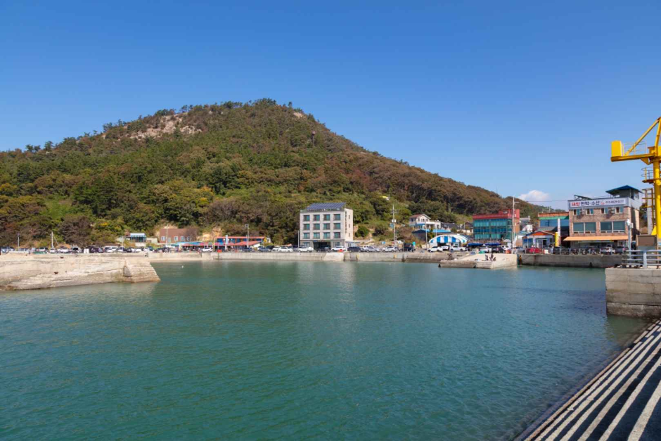
Daejang Island
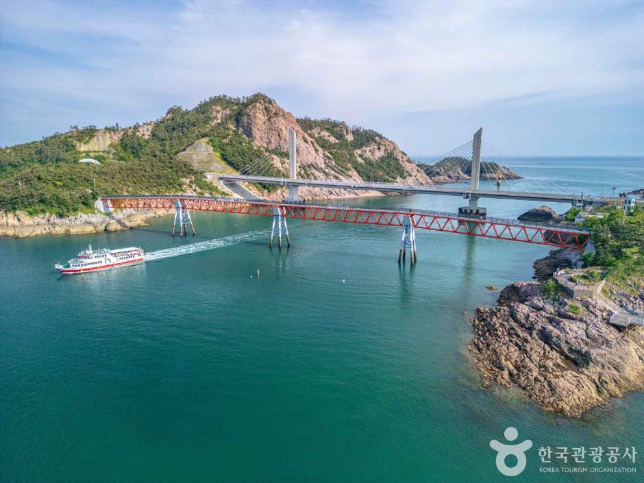
Once upon a time, a mysterious figure appeared on the island and predicted the construction of a long bridge in the future before disappearing. The locals believed in this prophecy and started calling the island ‘Daechangdo.’ Now, the modern Daechang Bridge conveniently connects the island with Jangjado.
Legend has it that ‘Halmae Rock,’ a formation at the foot of the mountain, turned into stone while waiting for her husband, who went fishing with their baby on his back. This rock remains a symbol of longing and local folklore.
A must-visit spot on the island is the exhibition showcasing a diverse collection of seashells and minerals, collected by an individual over several decades. This unique display offers insight into the island’s natural history and the collector’s passion.
The breathtaking views of sunrise and sunset from the hill in front of the bridge leading to Jangjado are truly mesmerizing. This tiny 0.34㎢ island resembles a picturesque painting and offers a peaceful and serene typical fishing village atmosphere.
Connected by bridges to Seonyudo and Jangjado, visitors can enjoy walking or cycling around the island. It takes about 30 minutes to walk to Seonyudo , making it easy to explore the surrounding islands and enjoy the tranquil scenery.
• Address (location): Daejangdo, Okdo-myeon, Gunsan-si, Jeollabuk-do
• Hours of use: Open all the time for visitors
Munyeo Island
Munyeo Island is located in the sea 50.8 kilometers southwest of Gunsan City, forming part of the Gogunsan Archipelago along with Seonyudo, Sinsido, and Jangjado. With an area of 1.75 square kilometers and a coastline of approximately 11.6 kilometers, Munyeo Island stands out from other islands in the archipelago with its extensive paddies and salt fields, earning it the nickname “land within an island”. Specifically, the island is home to 99,174 square meters of paddies and 595,044 square meters of salt fields, and the surrounding waters are abundant in marine resources.
Currently, bridges connect Munyeo Island to Seonyudo, Seonyudo to Jangjado, and Jangjado to Daejangdo, allowing visitors to walk or cycle between the islands as if they were one continuous landmass. The landscape of Munyeo Island is characterized by the absence of high mountains, with the exception of Munyeobong Peak, which rises to 131 meters in the southwest. The coastline is gently curved, and extensive salt fields stretch along the northern coast.
Munyeo Island enjoys a generally mild climate, with an average temperature of around -1°C in January, 27.3°C in August, and annual rainfall of approximately 1,291 millimeters. The island’s easy connectivity, unique agricultural landscape, and serene coastal scenery make it a notable destination within the Gogunsan Archipelago.
• Address (location): Mu Nyeo Village, Okdo-myeon, Gunsan-si, Jeollabuk-do
• Hours of use: Open all year round
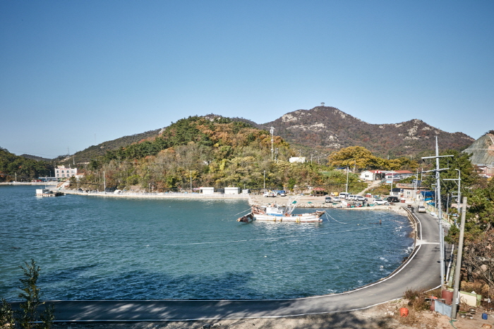
Seonyudo
Seonyudo, originally known as Gunsan Island, was named for its resemblance to two immortals (gods) sitting across from each other playing baduk on the summit of a 100-meter-high hill at the northern tip of the island. With an area of approximately 2.12 km² and a population of over 500, Seonyudo serves as the central island of the Gogunsan Archipelago, which includes Sinsido, Munyeodo, Bangchukdo, and Maldo.
Seonyudo has historically been a significant strategic point in the West Sea. During the Joseon Dynasty, it served as the headquarters of the naval forces and was under the control of the naval commander. In the Goryeo Dynasty, it was a port of call on the Yeosu-Song trade route. During the Imjin War, Admiral Yi Sun-sin stayed on the island for several days after his victory at the Battle of Myeongnyang to reorganize his fleet before his next engagement.
The island is renowned for its scenic beauty, with Jinmal in Seonyudo considered the centerpiece of the “Gunsan Eight Scenic Views.” Seonyudo is home to several family clans, including the Lee, Kim, Park, Im, and Go families. While traditional folk beliefs and ceremonies such as Oro Myoje, Jangsaengje, Susinje, and Burakje were once practiced, these customs have since been discontinued.
Historical artifacts on the island include the Paechong and the naval commander’s monument. Today, Seonyudo is easily accessible via Jangjado and the connecting bridges, making it a popular destination for visitors seeking the natural and cultural heritage of the Gogunsan Archipelago.
• Address (location): 34-22, Seonyunam-gil, Okdo-myeon, Gunsan-si, Jeollabuk-do
• Hours of use: Open all year round
Sinsido Island Fishing Village
Sinsido Island is located to the east of Seonyudo and is the largest among the 24 islands in the Gogunsan Archipelago, covering an area of 4.25 square kilometers with a coastline stretching 16.5 kilometers. The highest point on the island is Daegaksan at 187 meters in the northwest, while Sinchisan rises to 142 meters in the southeast. The island features many hills and low mountainous areas, most of which are below 200 meters in elevation.
Fishing is the predominant occupation for residents, especially in the southern Jipung-geum (Jipoonggeum) village, where various seafood such as shrimp, anchovy, cutlassfish, and mackerel are caught, and seaweed (laver) farming is active. The island also produces crops like rice, barley, sweet potatoes, peppers, and beans, allowing for a largely self-sufficient lifestyle.
Sinsido is connected to the mainland via the Saemangeum seawall and is accessible by car, making it convenient for visitors. Experiential tourism activities such as farming, clam digging, and fishing are popular, especially through the fishing village experience programs. The island’s gentle hills, scenic coastline, and rich marine resources make it a vibrant destination within the Gogunsan Archipelago.
• Address (location): 83-7 Sin Sido-gil, Okdo-myeon, Gunsan-si, Jeollabuk-do
• Hours of use: Open all day